An island is a landmass that is surrounded by water from all directions. In this article, we will see what are some of the largest islands in the world. Let’s read.
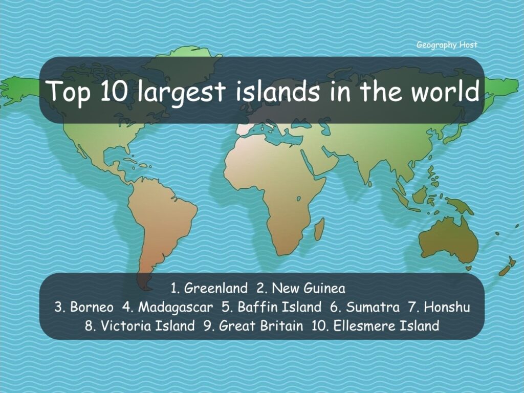
Top 10 largest islands in the world
(Note: The continental landmasses Australia, Antarctica, Americas, and Afro-Eurasia are not considered.)
1. Greenland
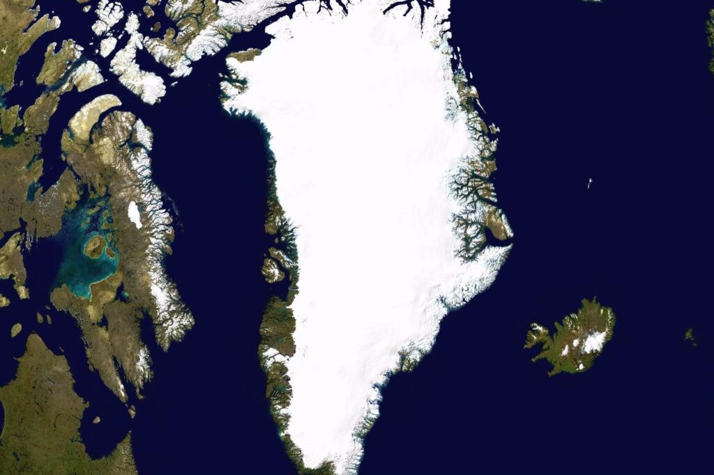
The main island of Greenland is the largest island in the world. The island has an area of 2.13 million sq km/ 0.822 million square miles. Greenland is surrounded by the Arctic and North Atlantic Oceans and has a small population of only about 56,000.
Greenland is a part of the Kingdom of Denmark but remains autonomous. The Greenland ice sheet that covers 80% of Greenland is the second largest ice sheet/ice accumulation in the world after the Antarctic ice sheet.
Area: 2.13 million sq km/ 0.822 million square miles
2. New Guinea island
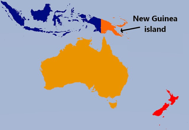
The New Guinea island is the second-largest island in the world. It has an area of 785,750 sq km/303,380 square miles. The island is divided almost equally with the western region being part of Indonesia and the eastern region being an independent country Papua New Guinea.
Area: 785,750 sq km/303,380 square miles
3. Borneo
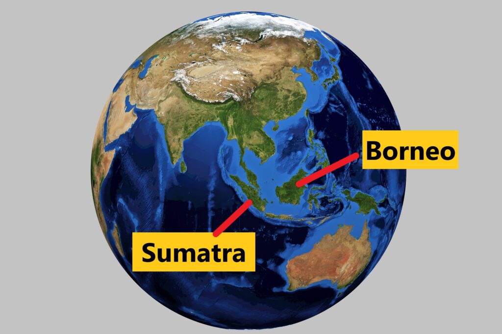
With an area of 748,200 sq km/288,900 square miles, the Borneo island located in Southeast Asia is the third-largest island in the world. The island is divided into three countries – Malaysia, Indonesia, and Brunei.
Brunei is a small country located completely on Borneo island. Indonesia and Malaysia have a major portion of their land area on the Borneo island.
Area: 748,200 sq km/288,900 square miles
4. Madagascar
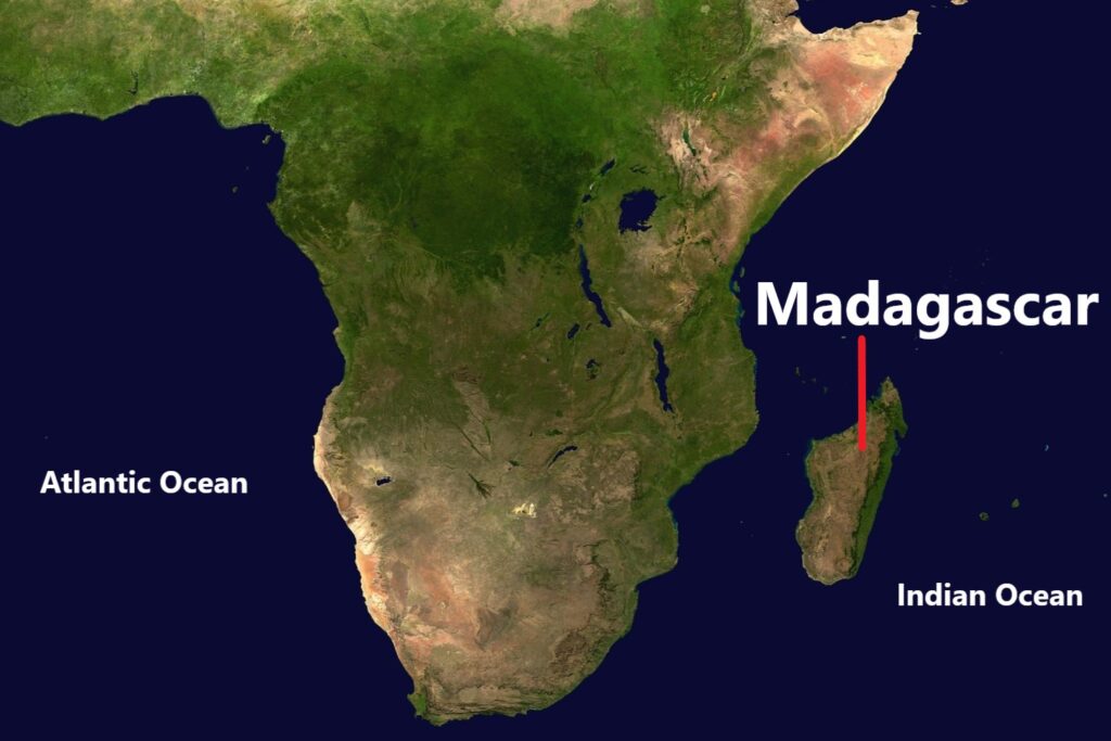
Madagascar is a large island located in the Indian Ocean, east of the main African landmass. The island has an area of 587,000 sq km/226,650 square miles. Madagascar is one of the most biologically diverse nations in the world with various climatic zones and ecosystems.
Area: 587,000 sq km/226,650 square miles
5. Baffin island
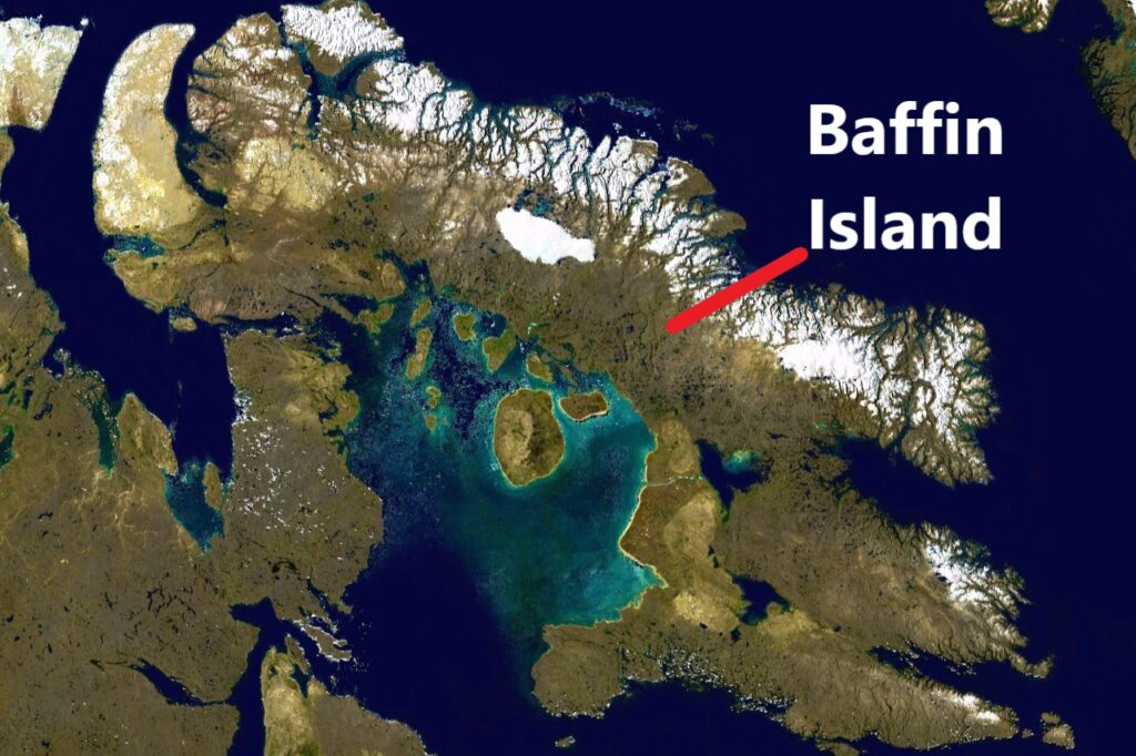
Baffin Island is the largest island in the Canadian Arctic Archipelago. Part of the Nunavut territory of Canada, Baffin island has an area of 507,450 sq km/195,927 square miles.
There are only a few human settlements on Baffin island. The largest one is Iqaluit, the capital of Nunavut. Iqaluit has a population of 7000-8000.
Area: 507,450 sq km/195,927 square miles
6. Sumatra
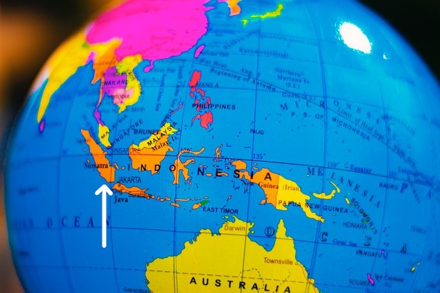
Sumatra is one of the main islands of Indonesia. The island has an area of 443,065 sq km/171,068 square miles and is the sixth-largest island in the world. Sumatra is a part of the Greater Sunda island group that includes Java and Borneo islands as well.
Area: 443,065 sq km/171,068 square miles
7. Honshu
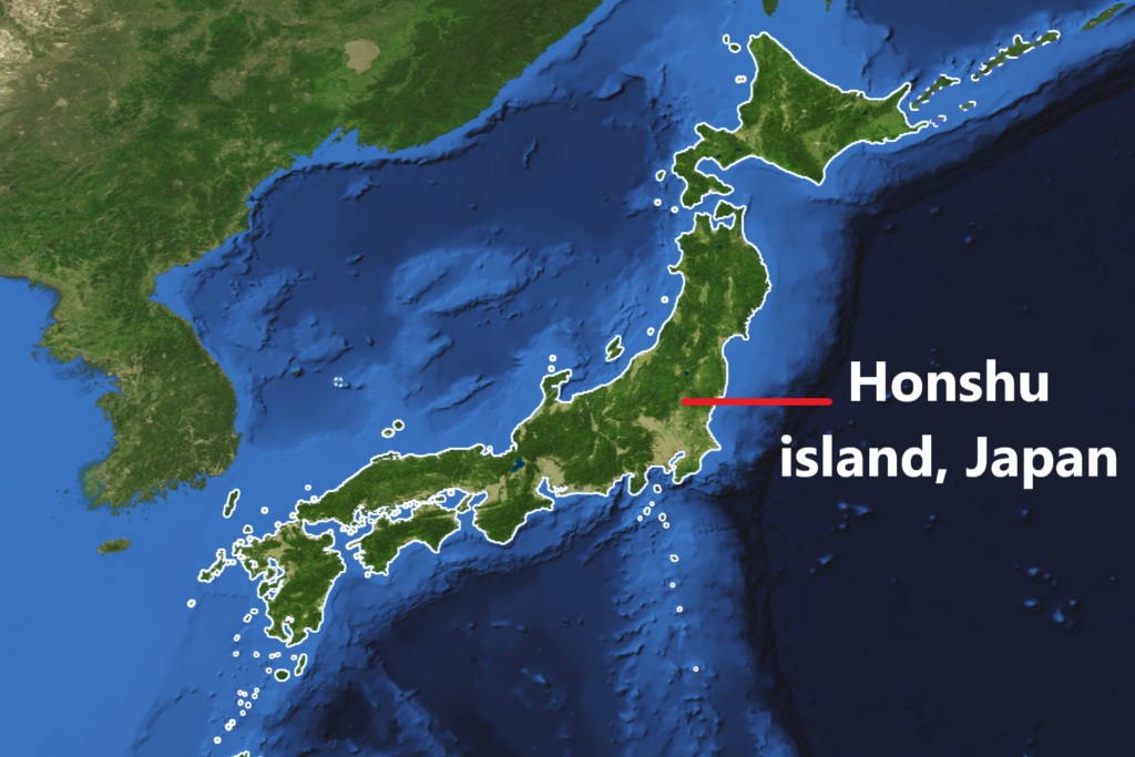
Honshu is the largest and the most populous island of Japan/Japanese archipelago. The island has an area of nearly 228,000 sq km/88,030 square miles and a population of 104 million. Most major cities of Japan like Tokyo, Osaka, and Yokohama are located on Honshu island.
Area: 228,000 sq km/88,030 square miles
8. Victoria island
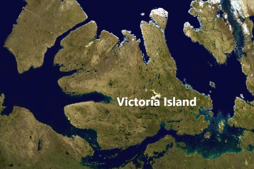
Victoria Island is the second-largest island of the Canadian Arctic archipelago. The island has an area of 217,300 sq km/83,900 square miles and a small population of about 2000.
Area: 217,300 sq km/83,900 square miles
9. Great Britain
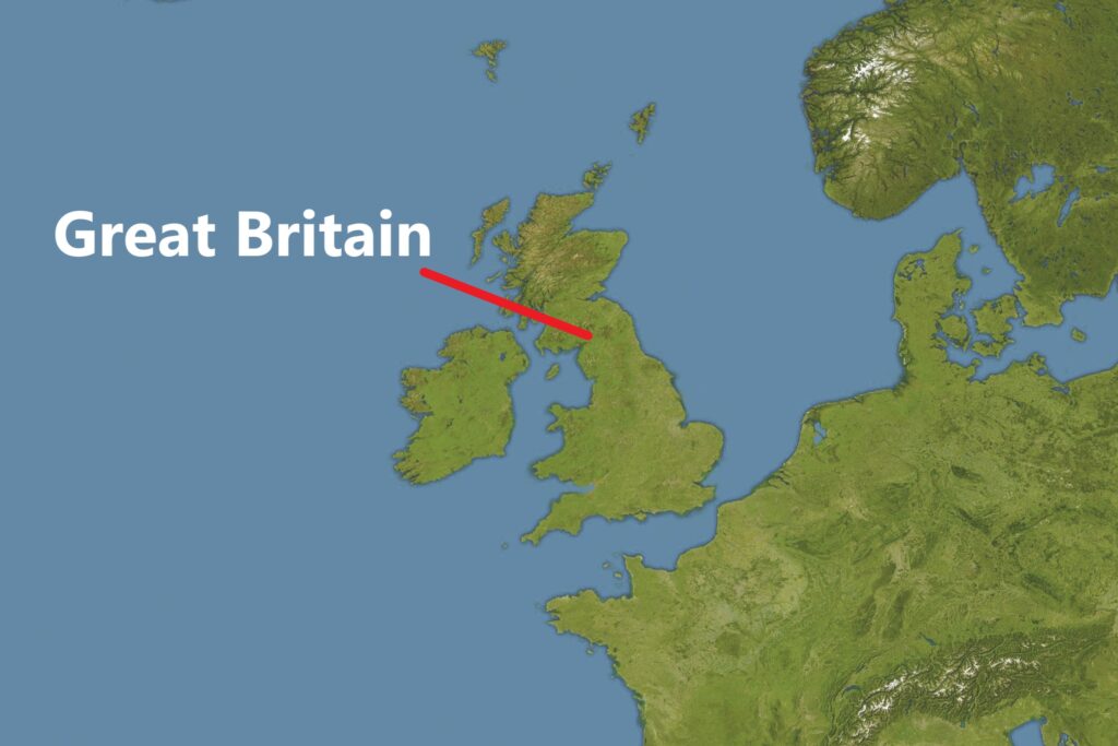
Great Britain is the largest island in Europe and the third most populous island in the world. It has an area of 209,331 sq km/80,823 square miles.
Area: 209,331 sq km/80,823 square miles
10. Ellesmere island
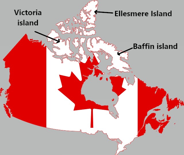
Number 10 on the list of largest islands in the world is the Ellesmere island of Canada. The island has an area of 196,236 sq km/75,767 square miles and a small population of only about 200.
Area: 196,236 sq km/75,767 square miles
List of largest islands in the world
| Rank | Island name | Approximate area |
| 1 | Greenland | 2.13 million sq km/ 0.822 million square miles |
| 2 | New Guinea | 785,750 sq km/303,380 square miles |
| 3 | Borneo | 748,200 sq km/288,900 square miles |
| 4 | Madagascar | 587,000 sq km/226,650 square miles |
| 5 | Baffin Island | 507,450 sq km/195,927 square miles |
| 6 | Sumatra | 443,065 sq km/171068 square miles |
| 7 | Honshu | 228,000 sq km/88,030 square miles |
| 8 | Victoria Island | 217,300 sq km/83,900 square miles |
| 9 | Great Britain | 209,331 sq km/80,823 square miles |
| 10 | Ellesmere Island | 196,236 sq km/75,767 square miles |
| 11 | Sulawesi | 180,680 sq km/69,760 square miles |
| 12 | South Island of New Zealand | 150,437 sq km/58,084 square miles |
| 13 | Java | 138,800 sq km/ 53,591 square miles |
| 14 | North Island of New Zealand | 111,583 sq km/43,082 square miles |
| 15 | Luzon island of Philippines | 110,000 sq km/42,471 square miles |
| 16 | Newfoundland | 108,860 sq km/42,031 square miles |
| 17 | Cuba | 105,800 sq km/40,850 square miles |
| 18 | Iceland | 101,826 sq km/39,315 square miles |
| 19 | Mindanao island of Philippines | 97,530 sq km/37,657 square miles |
| 20 | Ireland | 84,421 sq km/32,595 square miles |
Read more