A cloud is a visible mass of tiny water droplets or ice crystals suspended in the Earth’s atmosphere, formed when warm, moist air rises and cools. There are ten basic types of clouds, which are classified into four main groups based on their altitude.
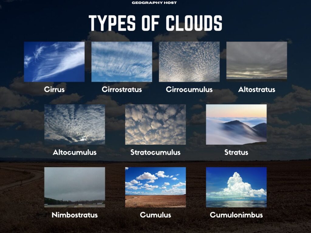
Types of clouds
- High-level clouds (Cirrus, Cirrostratus, Cirrocumulus)
- Mid-level clouds (Altostratus, Altocumulus)
- Low-level clouds (Stratocumulus, Stratus, Nimbostratus)
- Vertical clouds (Cumulus, Cumulonimbus)
| Polar Region | Temperate Region | Tropical Region | |
|---|---|---|---|
| High-level clouds | 10,000-25,000 ft (3-8 km) | 16,500-45,000 ft (5-14 km) | 20,000-60,000 ft (6-18 km) |
| Mid-level clouds | 6,500-13,000 ft (2-4 km) | 6,500-23,000 ft (2-7 km) | 6,500-25,000 ft (2-8 km) |
| Low-level clouds | 0-6,500 ft (0-2 km) | 0-6,500 ft (0-2 km) | 0-6,500 ft (0-2 km) |
High-level clouds
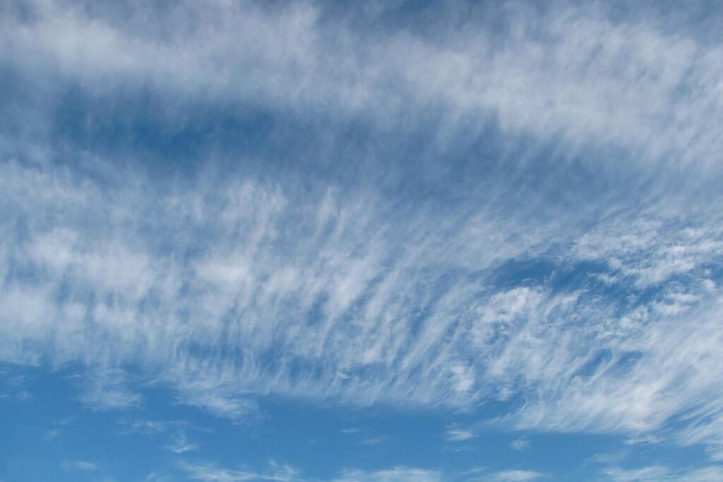
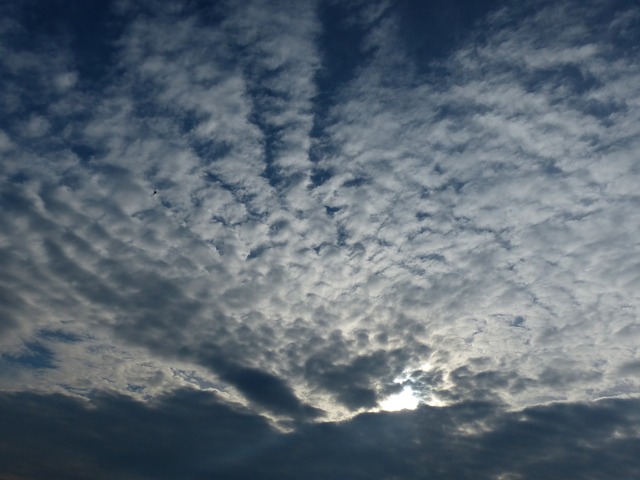
1. Cirrus clouds
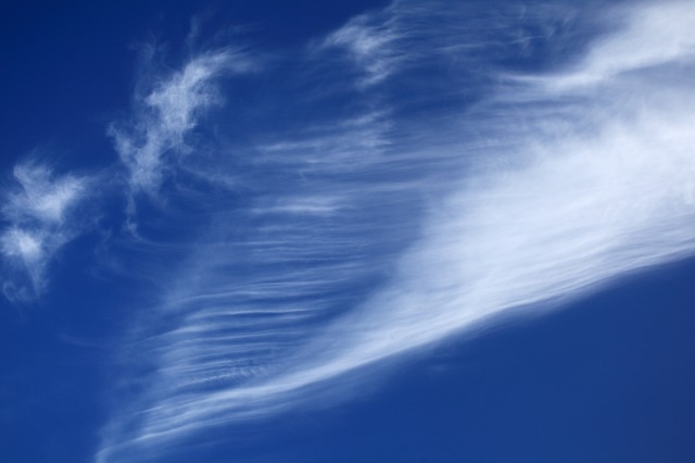
These are thin, hair-like clouds made entirely of ice crystals. Cirrus clouds are also known as “mare’s tails” because of their wispy appearance. Cirrus clouds often indicate fair weather but can also signal that a change in the weather is coming.
2. Cirrostratus clouds
Cirrostratus clouds appear as transparent, thin sheets covering large portions of the sky. They are composed primarily of ice crystals. When sunlight passes through these clouds, a halo often forms around the sun.
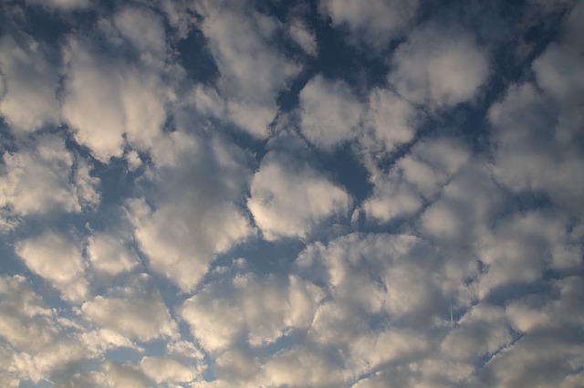
3. Cirrocumulus clouds
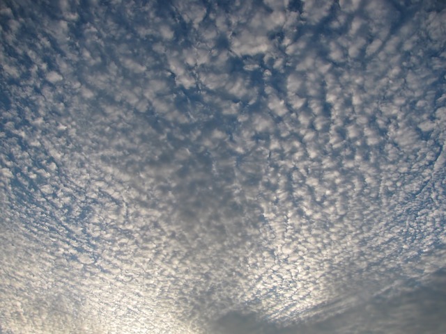
These clouds have a patchy, rippled appearance. A sky filled with cirrocumulus clouds is often called a “mackerel sky” because the cloud pattern resembles fish scales. (Mackerel is a type of pelagic fish known for its scaly pattern). Cirrocumulus clouds are primarily made of ice crystals.
(Also read: Types of Rainfall | Convectional, Orographic, and Cyclonic)
Mid-level clouds
4. Altostratus clouds
Altostratus are gray or bluish-gray, sheet-like mid-level clouds that often cover the entire sky. Depending on their thickness and transparency, the sun may appear as a faint, blurred disk or may be completely obscured. Altostratus clouds are typically thicker and darker than cirrostratus clouds.
5. Altocumulus clouds
Altocumulus are mid-level, wool-like clouds that appear as white or gray globular patches or rolls. They also sometimes form a Mackerel sky, similar to cirrocumulus clouds. However, altocumulus clouds are typically larger, darker, and found at lower altitudes than cirrocumulus clouds. They indicate changing weather, especially when seen in the morning.
Low-level clouds
6. Stratocumulus clouds
Stratocumulus clouds are low-lying, bumpy clouds that may appear in rows or patches. They may bring light rain or snow.
7. Stratus clouds

Stratus clouds are low-lying, generally gray, flat, and uniform clouds that cover the sky like a blanket, often bringing light precipitation.
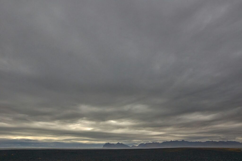
8. Nimbostratus clouds
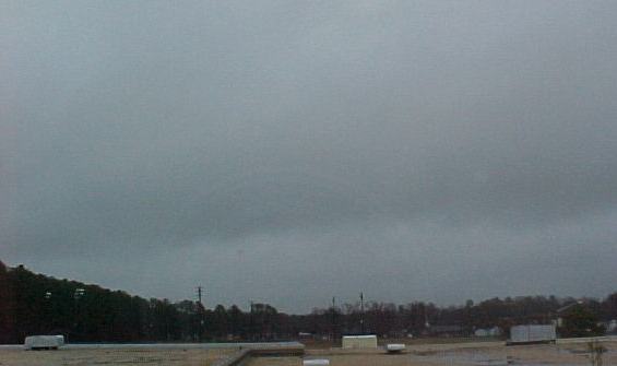
Nimbostratus clouds are generally thick, dark clouds that cover the sky completely and bring continuous rain or snow.
(Also read: How is rainfall measured? | What does 1 mm rainfall mean?)
Vertical clouds
9. Cumulus clouds
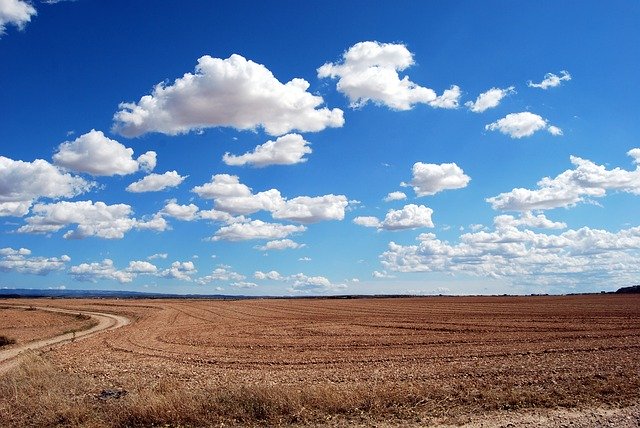
Cumulus clouds have a fluffy, cotton-like appearance with a flat horizontal base. These clouds generally do not have a great vertical height.
10. Cumulonimbus clouds

Cumulonimbus clouds have great vertical height and are associated with thunderstorms and severe weather.
Virga precipitation
Virga precipitation refers to rain or snow that evaporates or sublimates before reaching the ground. It is commonly produced by high and mid-level clouds
Read more