Assam is a state in northeastern India known for its cultural diversity, stunning landscapes, and amazing wildlife. Let’s learn 10 interesting facts about this beautiful state.
Assam state facts
1. Overview
Assam is the most populous state in northeastern India and the second-largest in terms of area after Arunachal Pradesh. The state shares its borders with seven states: Arunachal Pradesh, Nagaland, Manipur, Mizoram, Tripura, Meghalaya, and West Bengal.
There are also two international borders in Assam, the Bhutan border in the northwest and the Bangladesh border in the west and south. Overall, Assam is the 16th largest state in India and ranks 15th in terms of population.
2. Geography of Assam
Assam is surrounded by mountain ranges from almost every direction. The foothills of the eastern Himalayas lie to the north, the Purvanchal range to the east and south, and the Meghalaya Hills to the west.
A narrow border with West Bengal leads to the Siliguri Corridor, a 22-km wide passage that connects the Seven Sister States with the rest of India. The Brahmaputra is the most important river in the state. It serves as a lifeline for Assam but often causes devastating floods during the monsoon season.
3. One of the world’s largest river islands is in Assam
Majuli Island in Assam is one of the world’s largest river islands, with an approximate area of 875 sq km. The island was made a separate district in 2016.
4. One of the longest bridges in India is in Assam
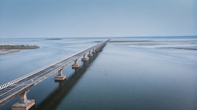
The Bhupen Hazarika Setu, also known as the Dhola-Sadiya Bridge, is one of the longest bridges in India. It spans 9.15 km over the Lohit River in Tinsukia district, Assam.
5. Tea production in Assam
The state of Assam is one of the world’s leading tea-producing regions, known for its rich, malty Assam tea that accounts for a major share of India’s total tea production.
6. History of Assam
The late medieval Ahom Kingdom covered much of present-day Assam. The kingdom was established in the 13th century by Sukaphaa, a Shan prince from Mong Mao. The Ahom Kingdom is known for successfully defending its territory against repeated Mughal invasions.
Post-independence, the state of Assam was gradually bifurcated to form the states of Nagaland, Meghalaya, Mizoram, and Arunachal Pradesh at different points in time.
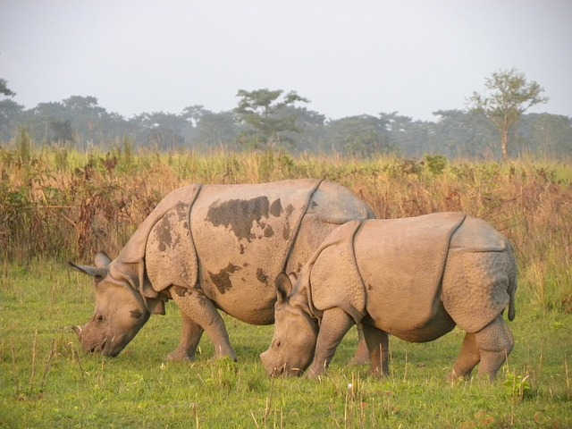
7. Assam is known for its national parks
There are seven national parks in Assam. The Kaziranga National Park is one the most famous national parks in India, known for its one-horned rhinos.
- Dibru-Saikhowa National Park
- Kaziranga National Park
- Manas National Park
- Nameri National Park
- Rajiv Gandhi Orang National Park
- Raimona National Park
- Dehing Patkai National Park
8. Capital of Assam
The capital of Assam is Dispur. Dispur is not a city on its own; it is a locality within the Guwahati metropolitan area.
9. Largest city in Assam
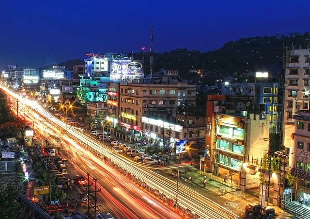
Guwahati is the largest city in Assam and the whole Northeast. It is located in the Kamrup Metropolitan district. As per the 2011 Census, the city had a population of about 10 lakhs.
10. Jorhat
Jorhat is often referred to as the ‘cultural capital of Assam’. It was also the last capital of the Ahom Kingdom.
Read more