Madhya Pradesh is a state in Central India. Like every Indian state, Madhya Pradesh is unique in its own way. At the same time, it possesses great diversity. Let’s learn some interesting facts about Madhya Pradesh, “the Heart of India”.
Interesting facts about Madhya Pradesh
Overview
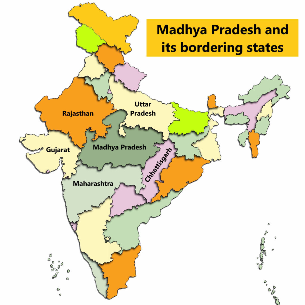
Madhya Pradesh is the second-largest state in India by area and the fifth-largest by population. It shares its borders with five states: Uttar Pradesh, Rajasthan, Chhattisgarh, Maharashtra, and Gujarat.
Geography of Madhya Pradesh
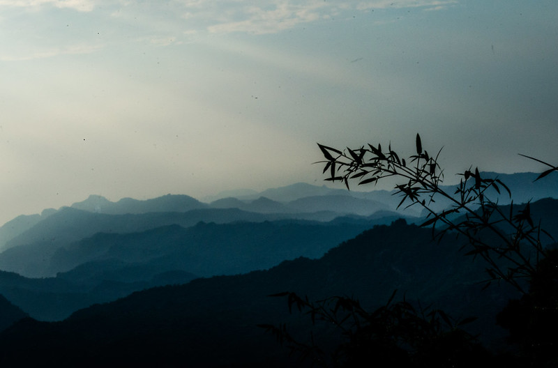
The topography of Madhya Pradesh is quite diverse. The mountain ranges of Vindhyachal and Satpura run parallelly across the state and are the source of many important rivers. The highest point in Madhya Pradesh is Dhupgarh which is 1,352 m above sea level.
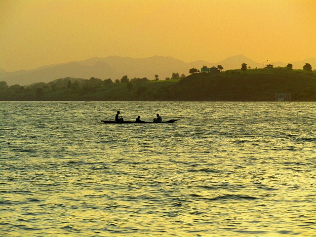
The sacred Narmada river originates in Madhya Pradesh at Amarkantak. Moreover, many other important rivers such as Tapti (Tapi), Betwa, Sone, etc. also have their origins in Madhya Pradesh.
Tourism in Madhya Pradesh
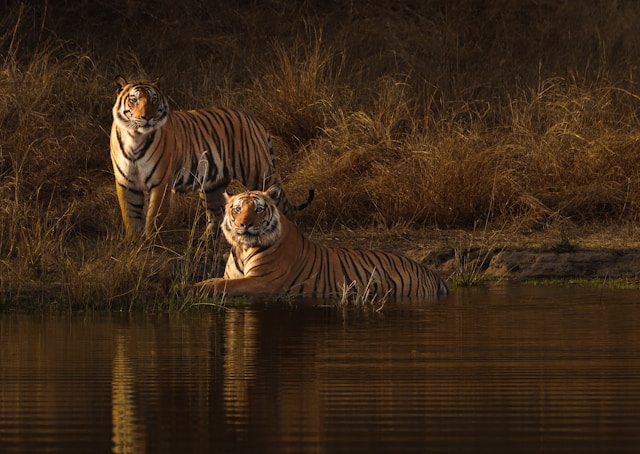
Madhya Pradesh is a great travel destination offering at least something to every kind of traveler. From magnificent temples and scenic mountains to amazing national parks, the state has it all. It is also renowned for some of the best tiger sightings in India. Here are some of the most popular places to visit in Madhya Pradesh.
- The Khajuraho Group of Monuments, the Buddhist monuments at Sanchi, and the Rock shelters of Bhimbetka are the three UNESCO World Heritage Sites in MP.
- The Bhimbetka Rock Shelters, located near Bhopal, are among the oldest known rock shelters in India. They are famous for their prehistoric cave paintings, some of which date back to the Paleolithic and Mesolithic periods.
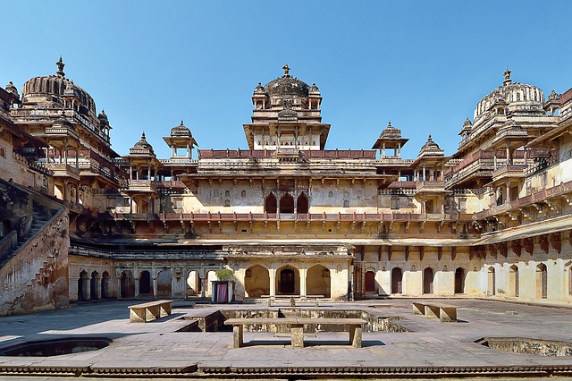
- Orchha, founded in the 16th century by Rudra Pratap Singh, is a famous town situated on the banks of the Betwa River. The town is known for its many historical sites and temples. Some famous ones are Shri Ram Raja Mandir, Chaturbhuj Temple, and the Orchha Fort complex.
- Pachmarhi, located in the Satpura Range, is one of the most popular hill stations in Madhya Pradesh. Often called the “Queen of Satpura,” Pachmarhi attracts many visitors, especially during the monsoon season, when the waterfalls are in full flow.
- Bandhavgarh National Park and Kanha National Park are among the best places for tiger sightings in India.
(Also read: 10 Interesting facts about Maharashtra)
Forests and National Parks
Madhya Pradesh has the highest forest cover area among all states in India. The total forest cover area in MP is 77,073.44 sq km (2023). Madhya Pradesh also has the most National Parks. There are 11 National Parks in MP.
- Bandhavgarh National Park
- Dinosaur Fossils National Park
- Fossil National Park
- Indira Priyadarshini Pench National Park
- Kanha National Park
- Madhav National Park
- Pench National Park
- Panna National Park
- Sanjay National Park
- Satpura National Park
- Van Vihar National Park
What is Madhya Pradesh known for?
Madhya Pradesh is known for its rich wildlife and numerous National Parks. It is often referred to as the “Tiger State of India” because it has the highest population of tigers in the country. The state is also known for its historical sites and temples.
(Also read: Uttar Pradesh facts – The mini India within India)
Some useful information
- Chhattisgarh was carved out of Madhya Pradesh on 1 November 2001.
- The jungles of Madhya Pradesh are believed to have inspired Rudyard Kipling’s classic novel The Jungle Book.
- Indore, in Madhya Pradesh, consistently ranks among the cleanest cities in India.
- The Bhopal Gas Tragedy of 1984 is considered the world’s worst industrial disaster, affecting more than 500,000 people.
- Madhya Pradesh literally translates to “Central State”.
Madhya Pradesh facts table
| Area | 308,252 sq km |
| Area rank | 2 |
| Population | 7.26 crores/72.6 million |
| Population rank | 5 |
| Capital | Bhopal |
| Most spoken language | Hindi |
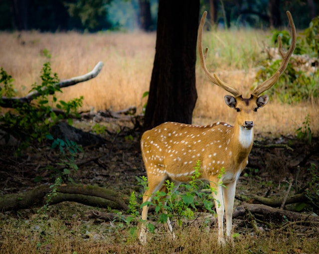
| State animal | Barasingha |
| State tree | Banyan |
| State bird | Indian paradise flycatcher |
I want to visit the National parks of Madhya Pradesh especially Kanha National Park.