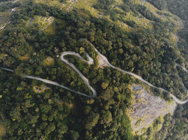
Mountain ranges make up a significant part of India’s land area. In the north are the Himalayas, while the Western Ghats run along the western coast and the Eastern Ghats along the eastern coast. In addition, India has several other regional mountain ranges. This article explores the major mountain ranges in India in detail. The post will be long and informative.
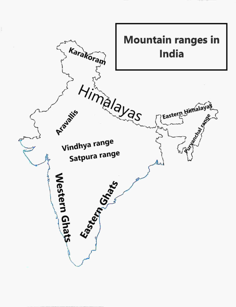
10 major mountain ranges in India
- The Himalayas
- The Western Ghats
- The Eastern Ghats
- The Ladakh Range
- The Satpura Range
- The Vindhya Range
- The Aravalli Range
- The Purvanchal Range
- Garo, Khasi, and Jaintia Hills
- The Karakoram Mountains
The Himalayas
The Himalayas are the tallest mountains in the world. This majestic range was formed when the Indian tectonic plate collided with the Eurasian plate around 40-50 million years ago. They are also the youngest major mountain range on Earth. Some studies have confirmed that the range is still growing by a few millimeters each year.
ADVERTISEMENT
The majority of the Himalayan mountains are in India. The third highest peak in the world, Kanchenjunga lies in the Sikkim state on the Indo-Nepal border. The peak is shared by India and Nepal.
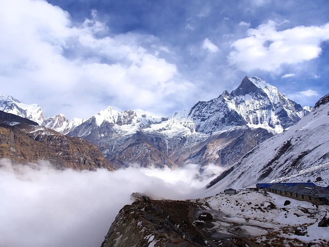
The Himalayas are an important mountain range for India and its neighboring countries. They are the source of many major rivers that sustain the population of the vast plains of the Indian subcontinent. They also block the southwest monsoon winds and force them to shed most of their moisture over the plains, making the region suitable for agriculture.
The mountain range is considered sacred in Hinduism and Buddhism. Many pilgrimage sites in the region are visited by large numbers of devotees every year. In addition, numerous tourist destinations and trekking routes make the Himalayas one of the most visited mountain ranges in the world.
Not considering the disputed regions, Nanda Devi in Chamoli, Uttarakhand is the highest peak that lies entirely in India. It has an elevation of 7,816 meters. The area around Nanda Devi is a biosphere reserve with two protected National Parks: Nanda Devi National Park and Valley of Flowers National Park.
Eastern and Western Himalayas
The Himalayas are commonly divided into the Western and Eastern Himalayas based on geographic and ecological differences. In India, the Eastern Himalayas are located in Sikkim, Arunachal Pradesh, and parts of West Bengal. The Western Himalayas are found in Jammu and Kashmir, Himachal Pradesh, and Uttarakhand.
Some key differences between Eastern and Western Himalayas are: (1) Snow line is higher in Eastern Himalayas as compared to Western Himalayas. (2) The amount of precipitation is greater in Eastern Himalayas. (3) Eastern Himalayas rise abruptly while Western Himalayas rise gradually.
There are three subranges of the Himalayas: Shivalik Hills, the lesser Himalayas, and the Greater Himalayas.
Shivalik hills
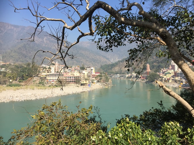
Shivalik hills (Shivalik range) are the foothills of the Himalayas. They separate the river plains from the higher mountains. The elevation of Shivalik hills ranges from a few hundred meters to 1,500 meters and sometimes over 2,000 meters. The famous tourist destinations of Rishikesh and Haridwar are located in the Shivalik range.
The three subranges of the Himalayas run parallelly for a 2,400 km stretch of the range. Out of all subranges, Shivalik hills were the last to form. The soil is alluvial containing the sediments and rocks that rivers bring along. The hills are heavily populated. The city of Dehradun in Doon Valley is a large city with more than 8 lakh population.
The Lesser Himalayas
The lesser or lower Himalayas is a range between Shivalik hills and Great Himalayas. Most hill stations, Shimla, Mussorie, Darjeeling, etc are located in the Lesser Himalayas. The landscape varies from coniferous forests to alpine meadows.
ADVERTISEMENT
Pir Panjal range in Kashmir, the Dhauladhar range in Himachal, Nag Tibba range in Uttarakhand are all part of the lesser Himalayas. The range rises to 6,000 meters at some points. Indrasan peak (6221 meters) is widely considered the highest point of the Lesser Himalayas.
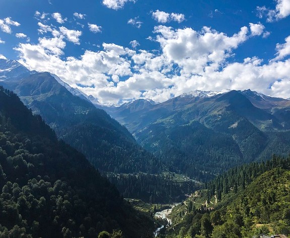
The Dhauladhars are probably the most famous of the lesser Himalayas. Its highest point is Hanuman Tibba which rises to 5,982 meters. Many hill stations like Manali, Dalhousie, and Dharamshala are located below the high Dhauladhars.
The Greater Himalayas
Greater Himalayas refers to the highest part of the Himalayas. Most high peaks of the Greater Himalayas in India rise above 6,000 meters and are snow-clad throughout the year. These mountains provide opportunities for mountaineers around the world to enter the record books.
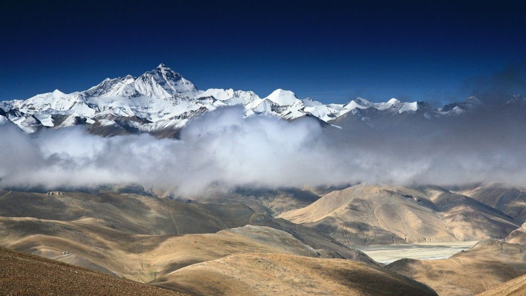
As mentioned above Nanda Devi is the highest peak lying entirely in India. The important Gangotri glacier the source of the Bhagirathi river and the Satopanth glacier, the source of the Alaknanda river are located in the Greater Himalayas. In fact, the streams coming from the Greater Himalayas provide water to the whole of North India.
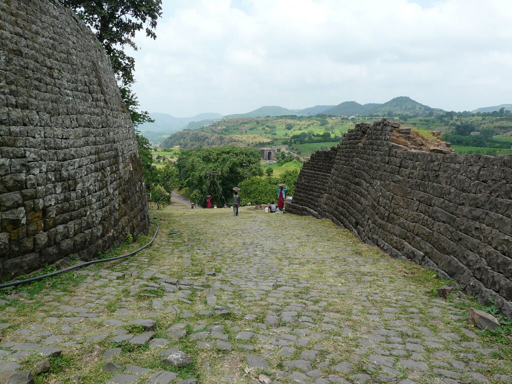
The Western Ghats
The Western Ghats are a mountain range that runs parallel to the western coast of India. This 1,600 km long range extends across the states of Gujarat, Maharashtra, Goa, Karnataka, Kerala, and Tamil Nadu. A UNESCO World Heritage Site, the Western Ghats are recognized as one of the world’s major biodiversity hotspots and are home to a rich variety of unique plant and animal species.
ADVERTISEMENT
Asian elephants, tigers, and the Nilgiri tahr are among the many species that find refuge in the protected forests of this region. Some well known national parks in the Western Ghats include Eravikulam National Park and Bandipur National Park, among others.
These misty mountains are a popular destination for trekking enthusiasts. You can enjoy many treks with incredible mountain views; however, most of them require permission from the forest department. The hill stations in the Western Ghats offer a welcome escape from the humid heat of the west coast cities. Some famous hill stations include Ooty, Munnar, and Mahabaleshwar.
The Western Ghats are older than the Himalayas, and their geological history is complex and still being studied. Some of the highest peaks in the range include Anamudi (2,695 m), Meesapulimala (2,640 m), and Doddabetta (2,637 m). Different sections of the range are also known by local names such as the Nilgiri Hills and the Anamalai Hills.
(Also read: The highest peak in South India – Anamudi | other high peaks)
The western side of the Western Ghats receives heavy rainfall during the monsoon season. For example, the town of Mahabaleshwar receives an average annual rainfall of around 5,600 mm. The major rivers of South India, including the Godavari, Krishna, and Kaveri, originate in the Western Ghats.
The Eastern Ghats
The Eastern Ghats run parallelly along the east coast of India. They are even older than the Western Ghats and are present in Odisha, Andhra Pradesh, Telangana, Tamil Nadu, and some parts of Karnataka.
The Eastern Ghats are not a continuous chain of mountains. It comprises of different local subranges. The highest peak is the Jindhagadh peak which has an elevation of 1,690 meters. The Eastern Ghats are not as high as the Western Ghats. But like the Western Ghats, they are rich in biological diversity with protected forests like Similipal National Park and Papikonda National Park.
Many rivers of South Central India originate from the Eastern Ghats. Also, the rivers originating in the Western Ghats are recharged by the Eastern Ghats before they drain into the Bay of Bengal.
Some famous hill stations in the Eastern ghats are Araku Valley, Lambasigni, Deomali, and Yercaud. The Eastern Ghats during the monsoon season is a sight to behold. These hills attract a lot of tourists from the nearby big cities in the monsoon months. The various adventurous treks that you can do in the Eastern Ghats include the Arma Konda trek, Jindhagadh peak trek, etc.
The Ladakh Range
Southeast of the Karakoram mountain, lies the Ladakh range. The range does not have many prominent peaks as the area around it is itself at a very high elevation. Located in the rain shadow of the Himalayas, the Ladakh range is one of the driest mountain ranges in India. The area is semi-arid with less vegetation.
The town of Leh is located south of the range. The Shyok river runs almost parallelly in the north while the Indus river runs parallelly in the south of the range.
The famous Khardung la and Chang la passes are located in the Ladakh range. These are some of the highest motorable roads in the world.
The Satpura Range
Satpura range lies in Central India in the states of Maharashtra, Madhya Pradesh, Chhattisgarh, and some parts of Gujarat. The highest point is Dhupgarh which has an elevation of about 1,350 meters.
This heavily forested range is the foremost place for Tiger conservation in India. The Kanha National Park, Bandhavgarh National Park, and Pench National Park are located in the Satpuras. These are some of the most famous National Parks in the country.
(Also read: National parks in India – full list)
Apart from the National Parks, other tourist places that you can visit in the Satpura hills are Amarkantaka, Panchmarhi, Muktaguri, etc. Amarkantak is a pilgrimage town from where the holy Narmada and Son rivers originate. Panchmarhi is a popular hill station with many waterfalls and religious sites. The best time to witness the waterfalls of Panchmarhi is during monsoons.
Rudyard Kipling wrote “The Jungle Book”, being inspired by the jungles of the Satpura range.
The Vindhya Range
Vindhya range is a discontinuous chain of hills north of the Satpura range. The hills are not very high with elevations of less than 1000 meters. Vindhyas are still not well defined and are sometimes mistaken for the Satpura range.
Many important tributaries of the Yamuna such as Chambal and Betwa originate from the Vindhya range. The tourist places are mostly religious. There are many small trekking trails that are recreational getaways for people living in nearby towns and cities.
The Aravalli Range
The Aravalli range is located in the northwestern part of India. It extends from the state of Gujarat to Rajasthan. There are some hills present in Southern Haryana also. The highest peak in the Aravalli range is Guru Shikhar which rises to 1,722 meters.
This old mineral-rich mountain range is mostly semi-arid and checks the further desertification of North India. The Aravalli range is one of the oldest mountain ranges in India. These are fold mountains that used to be much higher. As a result of weathering and erosion over millions of years, they lost their height.
The Luni river which is very important for the settlements of the Thar desert originates from the Aravali hills. Another major river, Sabarmati also originates from the Aravali range.
Some famous tourist destinations in the Aravali hills are Mount Abu, Udaipur, and Sariska Tiger Reserve.
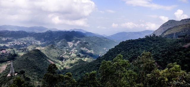
The Purvanchal Range
The Purvanchal range is present in Northeast India. It comprises of various local hill systems – Mizo hills, Tripura hills, Patkai bum hills, Naga hills, and Manipur hills. The Himalayas bend sharply and move southwards from the state of Arunachal Pradesh forming the Purvanchal range. The range moves along the Indo-Myanmar border reaching an elevation of over 3,000 meters at some places.
The hills are heavily forested and are home to various indigenous tribes. The amount of precipitation on these hills is generally higher than 2,000 mm per year. The tourist destinations in Purvanchal hills include the capital city of Aizawl, Dzüko Valley, and Namdapha National Park.
Garo, Khasi, and Jaintia Hills
Garo, Khasi, and Jaintia hills are present in the state of Meghalaya. The Garo are the Westernmost hills, Khasi hills are present in central Meghalaya and Jaintia hills are present east of the Khasi hills.
These mountain ranges in India have some of the wettest places on Earth. Mawsynram, the wettest place on Earth is located in the East Khasi hills. It receives on average, over 11,000 mm of precipitation every year. Cherrapunji, the former wettest place on Earth is also located in East Khasi hills.
Home to many tribes, the mountains of Meghalaya are famous for their natural beauty and biodiversity. There are many famous waterfalls and lakes. Some famous ones are Nohsngithiang Falls, NohKaLikai Falls, and Umiam lake. The Umngot river famous for its crystal clear water is located in the Jaintia hills bordering Bangladesh.
The Karakoram Mountains
The Karakoram range has some of the highest peaks in the world. The second highest peak in the world, K2 lies in the disputed Gilgit Baltistan region. Siachen glacier often referred to as the world’s highest battlefield is located in the Karakoram range. Siachen is one of the largest non-polar glaciers in the world.
These mountains are heavily snow-clad with many peaks above 7,000 meters in elevation. Karakoram mountain ranges in India largely remain off-limits for the general public being at a disputed location.
Map
Frequently Asked Questions (FAQs)
Himalayas
Aravalli Range
Himalayas
Western Ghats
very informative
Thank you
You have explained the mountain ranges of India so briefly and elaborately.
Thank you
Excellent explanation. So easy to digest. Thank you so much.
You’re welcome.