Himachal Pradesh is a Himalayan state in northern India. The state is a major tourist attraction with many beautiful hill stations and trekking routes. Here are some amazing facts about Himachal Pradesh. Let’s read.
Basic facts about Himachal Pradesh
| Area | 55,673 square kilometers |
| Area rank | 17 |
| Population | 68,64,602 (2011 census) |
| Population rank | 20 |
| State tree | Deodar |
| State animal | Snow leopard |
| Literacy rate | 82.80% (2011 census) |
| Number of districts | 12 |
| State bird | Western tragopan |
| Capital | Shimla and Dharamshala |
| State flower | Rhododendron campanulatum |
| Lok Sabha seats | 4 |
| Rajya Sabha seats | 3 |
Himachal Pradesh facts and information
Overview
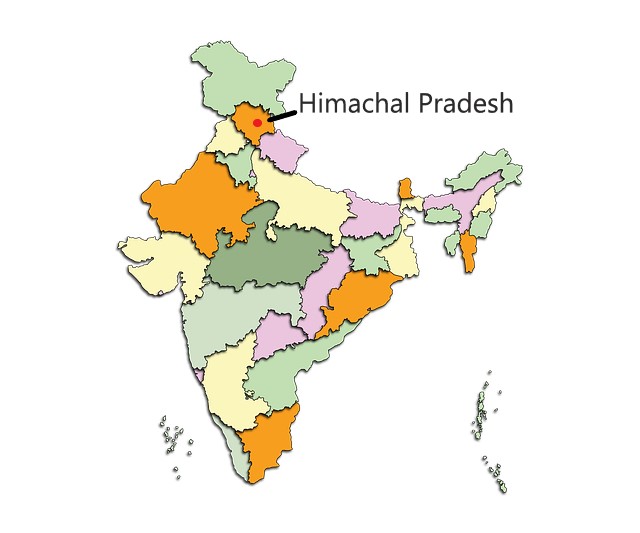
Himachal Pradesh has a population of 68,64,602 and an area of 55,673 square kilometers. The state is bordered by Ladakh in the North and Northeast, Jammu and Kashmir in the northwest, Tibet in the east, Uttarakhand in the southeast, Uttar Pradesh, and Haryana in the South, and Punjab in the west and southwest.
Geography
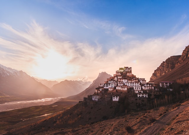
The state is mostly mountainous. The elevation increases as we move from southwest to northeast. Himachal Pradesh has basically four regions – the Shivalik hills, the lesser Himalayas, the greater Himalayas, and the trans-Himalayan region of Spiti and surrounding ranges. The highest peak in Himachal Pradesh is Reo Purgyil (6,816 meters).
(Also read: 10 major mountain ranges in India | subranges | destinations)
Forest cover and National parks
The forest cover in Himachal Pradesh as per the last survey is 15,443 square kilometers. 27.73 percent of the area in Himachal Pradesh is forest area.
There are 5 National parks in Himachal Pradesh.
- Great Himalayan National Park – 754.4 sq km area
- Inderkilla National Park – 104 sq km area
- Khirganga National Park – 710 sq km area
- Pin Valley National Park – 675 sq km area
- Simbalbara National Park – 27.88 sq km area
Districts
There are 12 districts in Himachal Pradesh.
- Bilaspur
- Chamba
- Hamirpur
- Kangra
- Kinnaur
- Kullu
- Lahaul and Spiti
- Mandi
- Shimla
- Sirmaur
- Solan
- Una
Lahaul and Spiti district is the largest district in Himachal Pradesh by area. The district has an area of 13,833 square kilometers. Kangra district is the most populous district in Himachal Pradesh.
Capital

Himachal Pradesh has two capitals – Shimla, the summer capital, and Dharamshala, the winter capital. Dharamshala was declared the second capital of Himachal Pradesh in 2017.
Tourism in Himachal Pradesh
Being a hilly state, there are many tourist destinations in Himachal Pradesh. The most visited ones are Shimla hill station, Spiti valley, Manali, Great Himalayan National Park, etc. There are many famous trekking routes in the state, most of which are religious pilgrimage routes, for instance, the Bijli Mahadev temple trek route, the Kinnaur Kailash trek route, the Manimahesh Kailash trek route, etc.
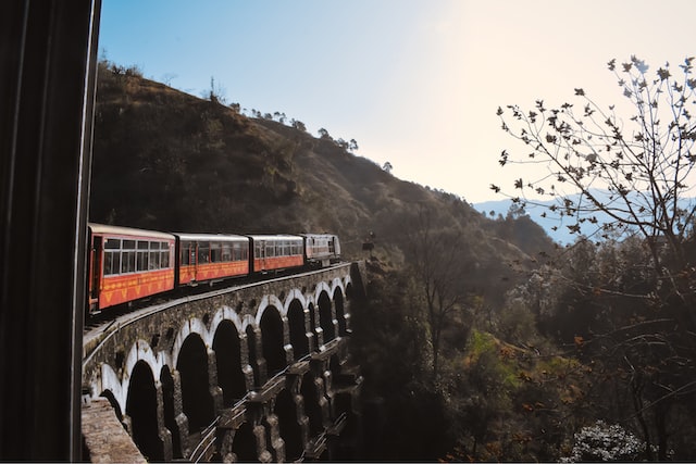
The two UNESCO World Heritage Sites in the state are –
- Kalka–Shimla Railways
- Great Himalayan National Park Conservation Area
Rivers originating in Himachal Pradesh
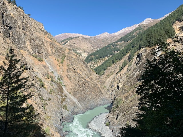
Many big rivers like Beas, Chenab, Ravi, etc originate from the glaciers or lakes in Himachal Pradesh. Beas originates from the Beas Kund in Kullu district, Chenab originates near the Baralacha La Pass in Lahaul and Spiti district, Ravi originates in the Kangra district.
High literacy rate

Himachal Pradesh had a literacy rate of 82.80% during the 2011 census. It is expected to be over 85% now. Himachal Pradesh has one of the highest literacy rates in India. The state is only behind Kerala, Mizoram, Tripura, and Goa in terms of literacy.
Dharamshala cricket stadium
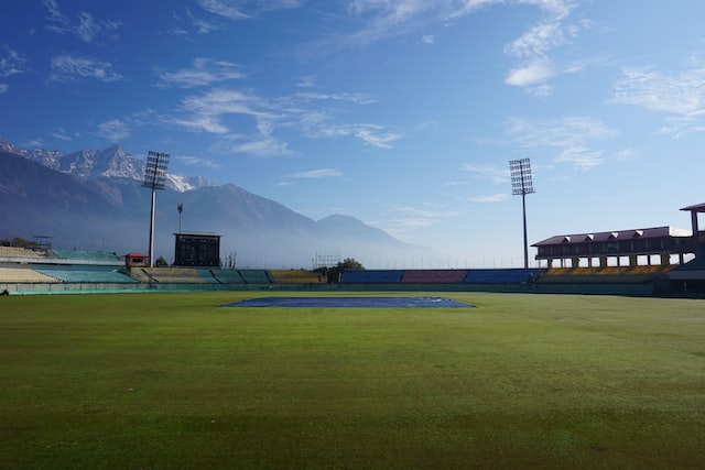
The Himachal Pradesh Cricket Association (HPCA) Stadium in Dharamshala is one of the highest international cricket stadiums in the world. The stadium has a capacity of 23,000 and is located at an elevation of 1,156 meters.
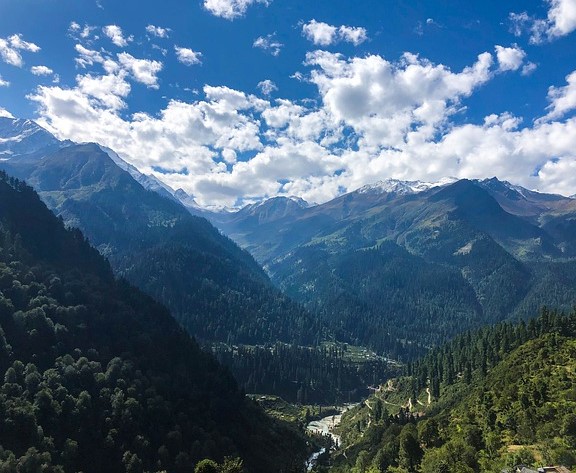
The famous Dhauladhar range in Himachal Pradesh
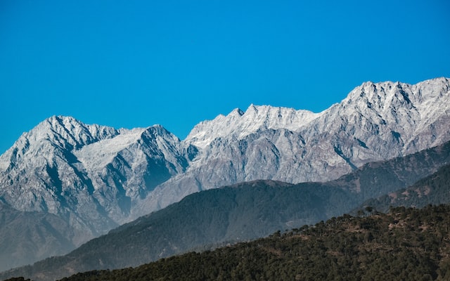
Dhauladhar range is a subrange in the Middle (lesser) Himalayas. It rises to up to 5,982 meters. Hanuman Tibba is the highest peak in the Dhauladhar range. The famous hill station of McLeod Ganj is located in the lap of the Dhauladhar range.
Refuge of Dalai Lama and many Tibetans
The 14th Dalai Lama along with many Tibetan refugees reside in Dharamshala, Himachal Pradesh. The Namgyal Monastery, one of the largest Buddhist monasteries in India, is also known as the “home of the Dalai Lama”.